Physiographic Divisions Of India
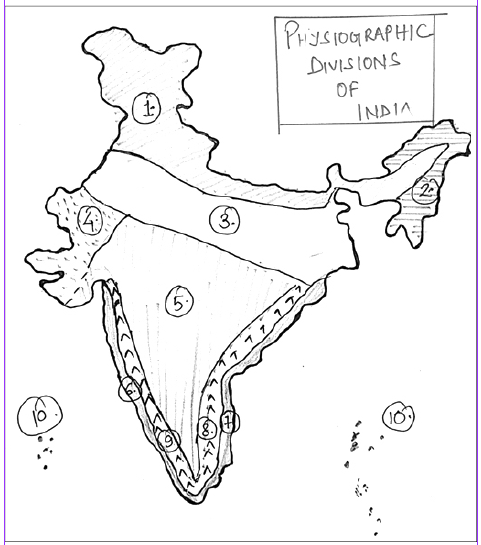
India is a vast country and is situated in a very significant geographical position surrounded by lofty mountains in the north and by water on all the three sides in the south. For the better geographical understanding of the Indian landmass, broadly we can divide Indian Territory into the following five geographical units:
- The Great Himalayas
- The North Indian Plains
- The Peninsular Plateau
- Coastal Plains (Eastern and Western)
- The Islands
We will try to comprehensively examine each division one by ....
Do You Want to Read More?
Subscribe Now
To get access to detailed content
Already a Member? Login here
Take Annual Subscription and get the following Advantage
The annual members of the Civil Services Chronicle can read the monthly content of the magazine as well as the Chronicle magazine archives.
Readers can study all the material since 2018 of the Civil Services Chronicle monthly issue in the form of Chronicle magazine archives.
Geography Of India
- 1 Coastal and Desert Landforms of India
- 2 Origin and Characteristics of Major River Systems
- 3 Integrated River Basin Governance
- 4 Interlinking of Rivers and their Ecological-Economic Trade-offs
- 5 Groundwater Stress Mapping
- 6 Patterns of Regional Disparities and Spatial Development in India
- 7 India’s Strategic Location in the Global and Regional Contexts
- 8 Geological Evolution of the Indian Subcontinent
- 9 India’s Geological Uniqueness: Some Salient Aspects
- 10 Peninsular Block, Himalayan Region, and Indo-Gangetic Plains: Comparative Features
